FOLLOWING on from a week of contrasts, increasingly warmer conditions will be spreading north eastwards across the UK, says the Met Office.
Met Office chief meteorologist Steve Willington said: 'The cold conditions from earlier in the week will linger longest in the far north of Scotland but the rest of the UK will see the transition to warmer, but more unsettled conditions. However, frost is still a possibility in central areas of the UK where cloud gives way to clearer spells.
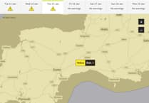
'Following on from Wednesday’s largely cloudy conditions, two areas of rain will move in overnight. Western Scotland and the South West will see the first rainfall, which could be heavy at times. In Scotland there is a chance of transient mountain snow as the rain band spreading from the west bumps into the colder air to the north and east.'
Chris Almond, deputy chief meteorologist, added: 'By Friday temperatures will have increased so that we will see values around 18-21C across parts of the UK.
'The coming bank holiday weekend itself will be a mixture of brighter conditions and showers. These showers will tend to be heaviest and most frequent in the west on Saturday. On Sunday most locations can expect to see at least some showers, whereas on the bank holiday Monday the focus for showers is more likely to be the east, with drier conditions elsewhere. Temperatures will be reasonable and above average.'
The first half of next week is likely to be dominated by high pressure but plumes of humid air from further south could bring the prospect of some heavier and potentially thundery showers.
It is still too far away to provide any great detail around the Coronation weekend, added the Met Office.


Comments
This article has no comments yet. Be the first to leave a comment.